
Remote sensing evidence
Satellite and terrain datasets are processed into interpretable exploration evidence.
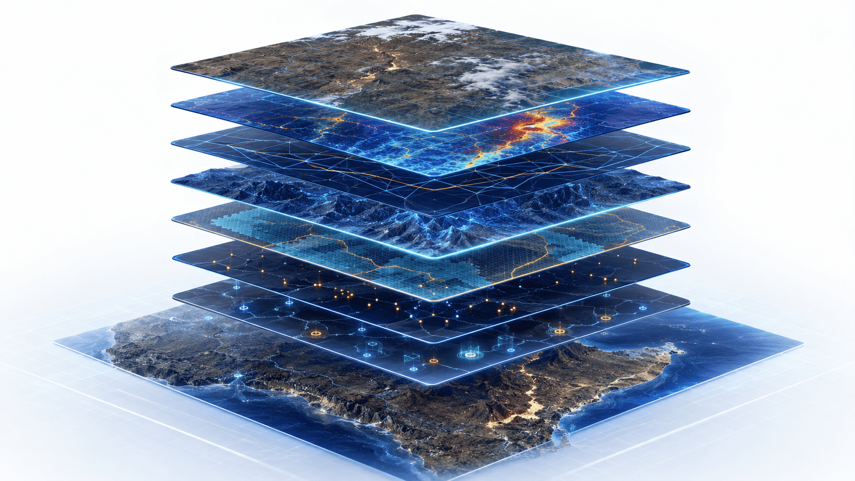
Xidar's technology stack connects satellite imagery, spectral processing, terrain analysis, structural interpretation, evidence stacking, field verification, QA/QC, lab integration, and decision-grade reporting into one traceable exploration workflow.

Satellite and terrain datasets are processed into interpretable exploration evidence.
Spectral, structural, and regional context are reviewed by humans before becoming recommendations.
Desktop outputs are designed to connect with field verification, sampling, QA/QC, and assay review.
Outputs are packaged as maps, GIS layers, target cards, executive summaries, and technical notes.
The stack is built for exploration uncertainty: organise the evidence, interpret it geologically, rank it cautiously, and keep the next validation step visible.
Satellite imagery, DEMs, geological layers, licence boundaries, legacy reports, field notes, client datasets, and project objectives are organised into a usable technical workspace.
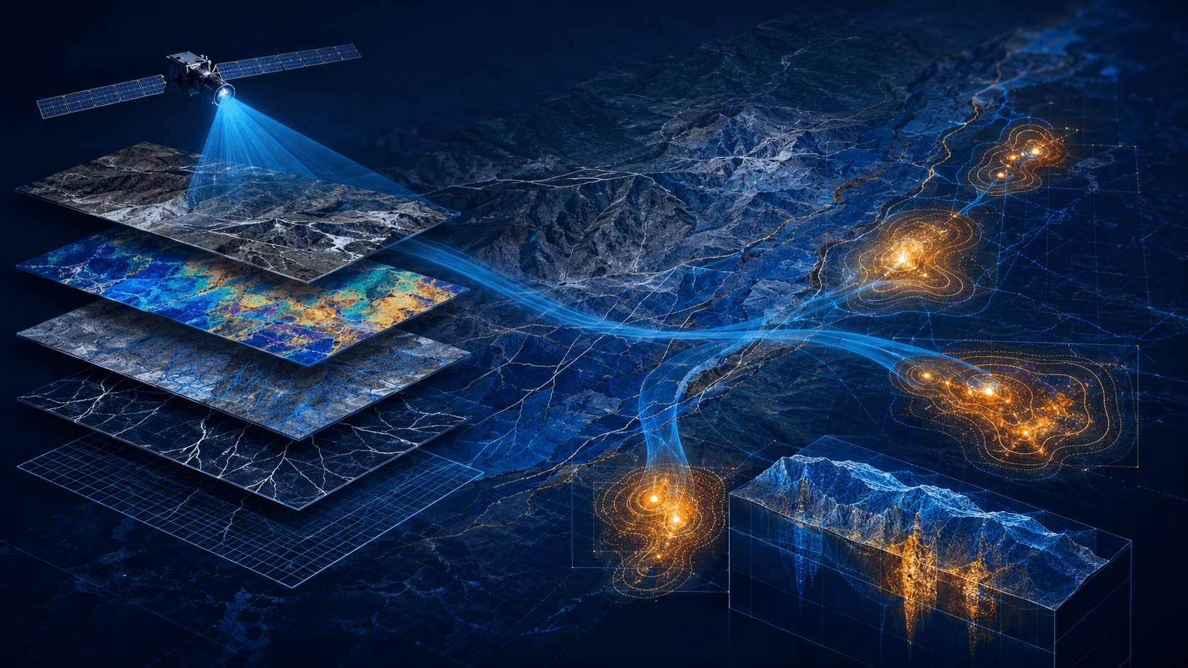
Multisensor imagery is processed to support alteration review, false-colour composites, clay, iron oxide, silica, lithological, vegetation, and terrain-context interpretation.
Lineaments, corridors, drainage patterns, terrain breaks, relief, access constraints, and structural controls are interpreted in relation to mineral-system logic.
Spectral, structural, geological, terrain, historical, and field evidence are combined to show where independent indicators converge.
Model-assisted scoring can help organise large areas and prioritise targets, but results remain interpretive and require geological review and field validation.
Each target should show why it matters, what evidence supports it, what uncertainty remains, and what should be checked next.
Findings are delivered as GIS layers, maps, target cards, ranked tables, technical summaries, and decision-support reporting.
Xidar integrates multiple data streams into a disciplined interpretation workflow, from satellite imagery and geological context to field verification, lab integration, and deliverable production.

Xidar uses satellite-derived evidence to support alteration mapping, lithological context, structural enhancement, terrain interpretation, and early-stage target screening.
Spectral evidence is a proxy layer. It must be interpreted with geological context and field validation before operational or investment decisions.
Evidence fusion is useful only when the interpretation remains explainable. Xidar uses stacked indicators to make target logic clearer, not to hide uncertainty behind a black box.
Spectral proxies
Structural lineaments
Terrain context
Geological knowledge
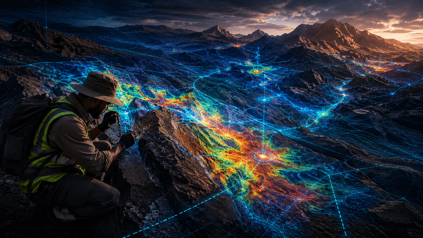
Field evidence
Lab results
Reporting logic
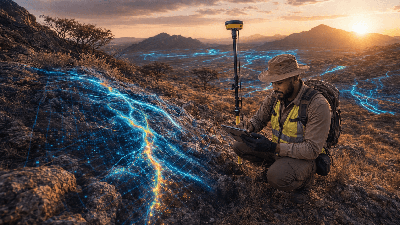
Xidar's technical system is built to move from desktop interpretation into field verification, sample governance, QA/QC, lab review, and updated target logic.
Desktop target
Field route
Structural observation
Sample logging
QA/QC
Lab result
Updated target model
Report output
Xidar's technology supports interpretation. It does not remove the need for geological judgement, careful evidence handling, and clear technical communication.
Workflows preserve clear evidence paths from screening through interpretation, field notes, lab review, and delivery.
Sampling logic, metadata, and handoff discipline help preserve traceability as programmes mature.
Assay results are read against QA/QC results, representativeness, geological observations, and target models.
Outputs are structured to support technical review and can be formatted for QP/CP review where formal disclosure is required.

Xidar's innovation focus is to make exploration workflows faster, more explainable, and more field-relevant by improving data integration, model-assisted ranking, interpretation dashboards, and repeat monitoring workflows.
Model-assisted ranking that helps organise large evidence stacks without replacing geological review.
Processing support for repeatable review of spectral, terrain, and structural indicators.
Cleaner technical workspaces for combining client data, regional context, field notes, and outputs.
Readable review surfaces that explain target logic, uncertainty, and next-step recommendations.
Structured refresh cycles for recurring area review, change tracking, and staged exploration planning.